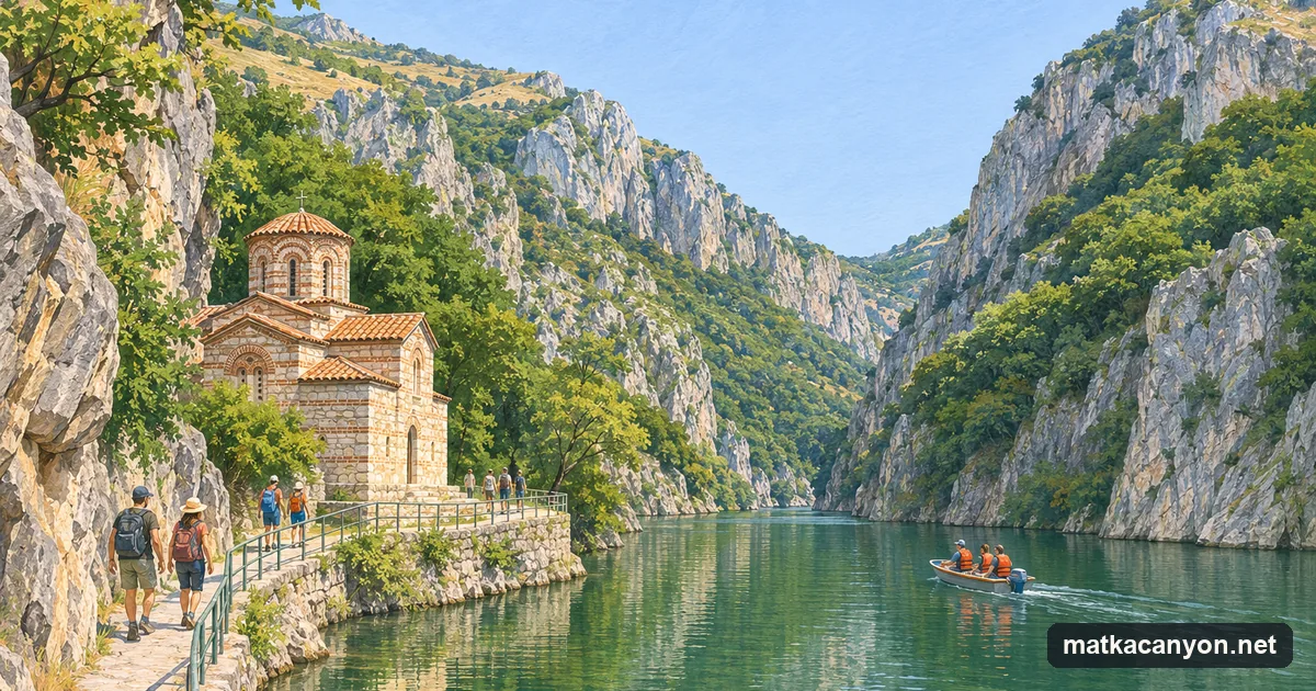
The Treska rises in the mountains of western North Macedonia and runs north to join the Vardar at Skopje. Its last stretch before the city is a narrow gorge in limestone, and at the mouth of that gorge a concrete arch dam has held back Lake Matka since 1938. The canyon is a day out from Skopje for kayakers, climbers, boat trips and people who come for the churches: the water is green and still, the walls rise straight from it, and the city’s buses reach the end of the road.
What the canyon is
The City of Skopje describes Matka as the canyon of the Treska, a right tributary of the Vardar, covering about 5,000 hectares 17 km south-west of the city. Its karst holds ten caves between 20 and 176 metres long and two vertical shafts up to 35 metres deep. The power company that runs the dam records 1,474 species of animals in the protected area, and 58 endemic invertebrates: 13 found only in the Balkans, 26 only in North Macedonia and 19 only in this area.
The City of Skopje declared the canyon a monument of nature in 1994. Under the country’s 2004 law on nature protection the area has to be declared again: in February 2023 the Government sent the Assembly a bill re-declaring Matka Canyon a monument of nature. The Assembly passed it at first reading in August 2024, then sent it back to the Ministry of Environment over objections from other state bodies, and at the end of November 2025 it was still with the Ministry (checked November 2026). Until a new law is passed, the 1994 decision remains in force. No body has been appointed to manage the canyon, and none runs a visitor centre for it.
Lake Matka and the dam
Work on the dam began in 1935 and the hydropower plant started in 1938. The dam is a concrete arch 29 m high with its crest at 317.5 m above sea level, and the lake behind it is the oldest artificial lake in the country. A second dam, Sveta Petka, closes the gorge upstream, and Lake Matka fills about 5 km of the gorge between the two. The old power house below the dam became an exhibition centre on electricity in 2016; it opens from April to October, every day except Monday, 10:00 to 15:00. The Lake Matka page covers the dam, the boats, kayak hire and swimming.
St Andrew and the monasteries
The church of St Andrew stands on the shore beside the dam. It was built in 1388-1389 by Andreaš, the second son of King Volkašin and brother of King Marko, and painted by the Metropolitan Jovan and the monk Grigorije, whose names are written near the altar. Around the lake are more churches: the Matka monastery of the Dormition of the Mother of God by the bus terminus, Holy Saviour, Holy Trinity and St Nedela on the slopes above St Andrew, and St Nicholas Shishevski on a terrace high above the opposite bank. See St Andrew and the monasteries.
The lakeside trail
The lakeside trail has been closed since 26 February 2026. On 7 January 2026 a large rock fell onto the path while visitors stood a few metres away. The Municipality of Saraj then banned all movement on the Matka path, acting on act no. 57-2071-1 of 19 February 2026 of the Directorate for Protection and Rescue, until further notice, and the Directorate put up warning signs for falling rock. No notice lifting the ban had been published when we checked on 1 November 2026.
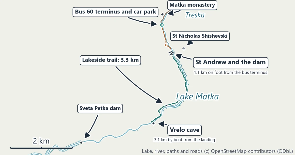
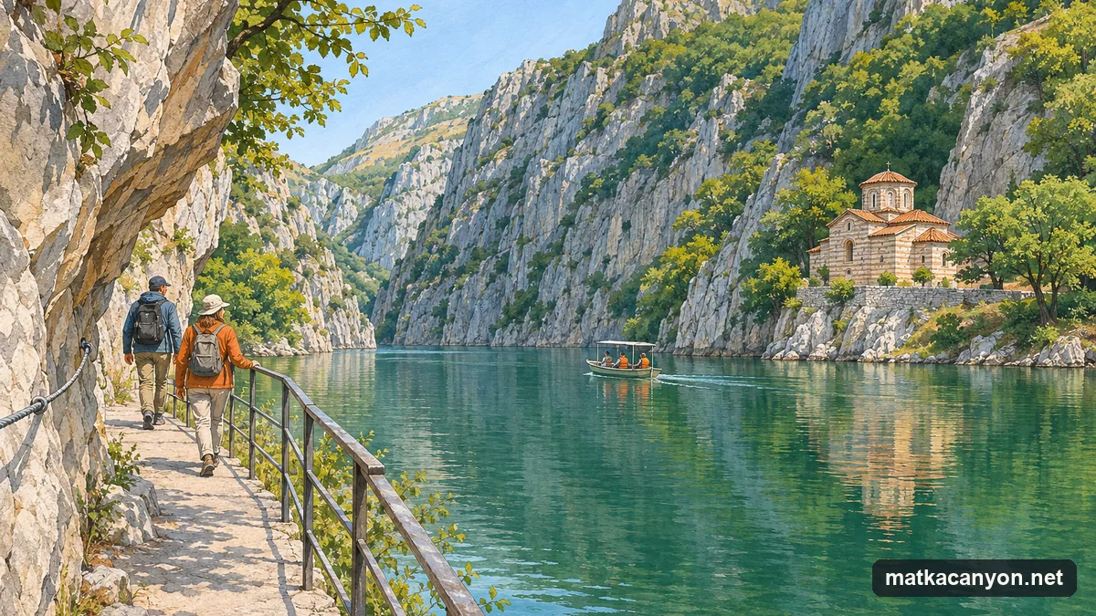
When it is open, the path follows the shore upstream from St Andrew for 3.3 km to Visok Rid, a point across the water from Vrelo cave, with railings and, in the narrow sections, a steel cable fixed to the rock; the City of Skopje began repairing both on 20 October 2023. The path ends there, so walkers come back the same way once it reopens. The trail page has the closure, the map and what to do instead.
Vrelo cave
Vrelo opens on the far bank of the lake, 3.1 km by boat from the landing below St Andrew. Boats land at the entrance of its dry upper cave, where a short route leads into halls with small lakes. Below the water the cave goes much deeper: in October 2026 a team of divers from North Macedonia, Poland and Italy reached 338 m, and the passage went on. The Vrelo cave page explains the boat trip and the dives.
Getting there from Skopje
| From | To | By road | Straight line |
|---|---|---|---|
| Macedonia Square, Skopje | Car park at the end of the road, Matka | 16.8 km | 12.0 km |
| Skopje International Airport | Car park at the end of the road, Matka | 46.2 km | 27.0 km |
| From | To | On foot |
|---|---|---|
| Bus 60 terminus, Matka | Church of St Andrew | 1.1 km |
| Bus 60 terminus, Matka | Matka monastery | 0.4 km |
Road and walking figures are routed along the mapped road and path network between the two points named; straight-line figures are the distance between the same points on the map. Bus 60 of JSP Skopje runs from the Transport Centre to the last stop at Matka, and the fare is 35 denars with a card or the Skopjebus app. The Skopje to Matka Canyon page has the timetable, taxis and parking.
When to go
Modelled averages for the canyon put July and August afternoons at about 31°C and January nights at about -3°C, with frost on about 20 nights in January. Spring and autumn are the mild seasons for a visit; in summer, come in the morning, before the heat of the afternoon. The weather and best time page has the month-by-month figures.
Staying safe
- Keep off the lakeside path while the ban stands. It has been closed since 26 February 2026 for falling rock; obey the warning signs on any path at Matka.
- Keep children close by the water. The dam, the landing and the church terrace stand above deep water.
- Wear shoes with grip. The rock and the concrete edges are slippery when wet.
- Do not swim from the shore. Boats use the lake, and the banks are steep rock with no way out of the water in most places.
- Carry water in summer. From the bus stop to St Andrew and back is 2.2 km on foot.
- Leave flowers, plants and animals where they are, and take your rubbish back: the canyon is a protected area.
Official information
- City of Skopje, the municipal authority that declared the canyon a monument of nature, with its environment portal at zivotnasredina.skopje.gov.mk (in Macedonian).
- Municipality of Saraj, the municipality the canyon lies in, which announced the ban on the Matka path in February 2026.
- JSP Skopje, the city bus company that runs line 60, with its journey planner and price list.
- HPP Matka, the power company’s page on the dam and the lake, and the Matka exhibition centre in the old power house.